Best Fishing Spots in the Gulf of Chiriquí

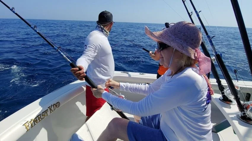
We’ve now made two trips to Sport Fish Panama Island Lodge and we’ve been amazed both times by the incredible fishing and scenery in the Gulf of Chiriquí. As the violent blue waves crash against the prehistoric islands, you half expect Mr. Roarke and Tattoo to welcome you to their little piece of terra firma. Indeed, it is a tropical paradise of sorts, but not in any way that was ever depicted on prime time television.
The many islands and rock formations give you a sense of why this fishery just southeast of Costa Rica is so good. It has a wildly changing topography that creates currents which bring in baitfish. It contains one of the largest coral reefs in the world, and much of it is within a National Marine Park. Indeed, SFPIL, located on Isla Parida, is the only fishing lodge within the park boundaries.
Of course, every famous fishery has key areas with either official or unofficial names to recommend them. In this case, many but not all of them are islands. Here’s what SFPIL owner/operator Captain Shane Jarvis had to say about some of the most well-known among them:

Isla Montuosa
“Montuosa is an island 50 miles offshore. A couple of miles west of there, there is a sea mount – a high spot – where the bonitos like to stack up. That’s a really good marlin spot and a lot of times we’ll find tunas around the edge there, too. Past that sea mount, a couple miles west, it drops off to a couple thousand feet. The marlin are called into that spot because the bonitos are there, and if the offshore stuff is not happening you can go right there to the island and fish shallow rocks in 50 or 60 feet for cuberas and jacks and rock snapper, a bunch of different species.”
Hannibal Bank
“Hannibal Bank and Montuosa are only 13 miles apart. Hannibal Bank is an underwater mountain out in the middle of nowhere. It rises up from 1,500 feet on the north side and it comes up to about 200 feet. It’s about 2 miles wide by about a mile long. Up on that mesa there’s a couple of high spots that come up to 90 to 110 feet on the west side of the bank. Right around those two high spots is where the bait likes to stack up, similar to the Montuosa high spot, but usually a little more active and prolific. The bonito like to hide there and the marlin know that. They come in from offshore to feed there all of the time.”

Isla Coiba
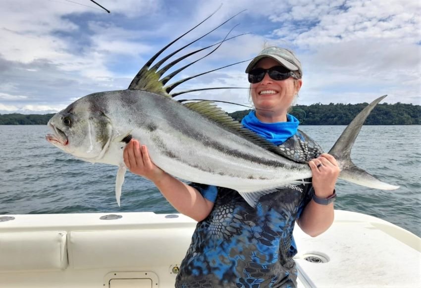
“Coiba is another 17 miles east of Hannibal Bank. Hannibal Bank is right in between Coiba and the west side of Montuosa. Coiba is so great because it’s a huge island. It’s massive, a hundred square miles, all undeveloped. It’s basically just a big jungle island. It’s about 20 miles offshore from the Azuero Peninsula in the middle of Panama. It’s a UNESCO World Heritage Site, which means it’s protected. The inshore fishing all around it for roosterfish, Cubera – the 20 or 30 species we catch around there are just everywhere. It doesn’t have a lot of pressure so the fishing is very good. We go within a mile of the shoreline to fish. There’s a lot of submerged rocks out off the island to fish, for those species that I mentioned. It’s awesome.”
Isla Ladrones
“Ladrones is 15 miles south of Parida here. It’s basically three or four rocks with a bunch of shrubs on them in the middle of nowhere. Out around Ladrones there’s a bunch of other submerged rocks, similar to all of these other volcanic islands in the Gulf of Chiriquí. We get all of the species there – roosterfish, Cuberas, blue jacks, mullet snappers. We catch a lot of wahoo over there because it’s a rock that juts up from 500 or 600 feet and it comes up to nothing right around the edge of the island there. It’s right on the edge of the 100 fathom line, which runs just east of the island here and runs south. Ladrones pops up right on that line and that 100 fathom line runs southeast to Montuosa, and at Montuosa it turns east to Hannibal Bank and all of those islands pop up on that 100 fathom line. Actually it’s a fault line that runs down the border of Costa Rica and Panama if you look on the map. The peninsula that juts down on the Panama and Costa Rica border, there’s a lot of earthquakes in that area right around there. That’s the drop off line where the water gets really deep.”

Other Named Places
“Isla Secas is 15 miles east of us. There’s some great inshore fishing in there, too, it’s a real pretty spot. There are some other islands north of Coiba, a little southeast of Secas called Isla Uva and Isla Contreras that are really good spots, too. They’re similar to what we have here. Depending on how fishing is we may run there and fish around there for inshore species, depending on the water clarity. At some time or another, the fishing gets really good around all of these islands.”
Additional Notes
Coiba National Park is over 1 million acres and holds over 150 species of birds.
Until 2004 Coiba contained a penal colony.
The Humboldt Current is a prime reason that areas like the Hannibal Bank hold so much biomass.
Isla Ladrones translates to “Thieves’ Island”
Most of the other nearby islands contain howler monkeys, but for reasons that are still unclear to us Isla Parida does not.